For the first time ever, a jitney route has its information displayed on Google Maps/Google Transit. Now travelers can access the route and (rough) schedule of the Paterson-George Washington Bridge jitney route when searching for transit directions.
Google Transit works off of a data format called GTFS. Usually, public transit agencies convert their routes and timetables into GTFS files, which Google Transit then verifies and publishes. Jitney companies do not have the technical expertise necessary to compile this information. In this case, the New York City Department of Transportation (NYCDOT) assisted with converting information about jitney operation into Google-friendly format.
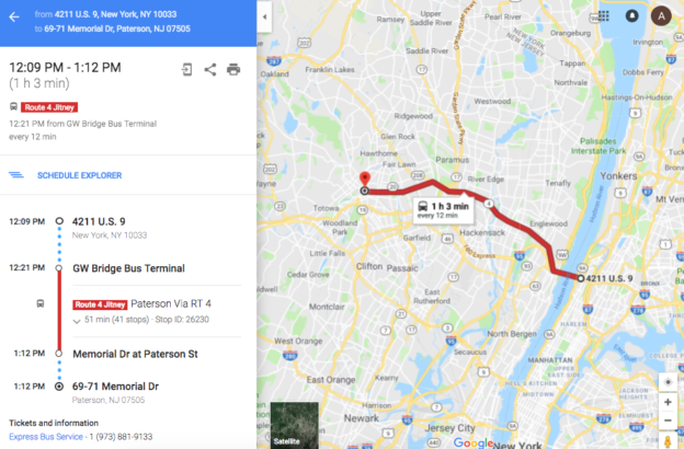
There is an interesting issue here- how do you convert an unscheduled jitney route into a publishable bus schedule? The solution here was to provide approximate headways. The Google Transit schedule shows Paterson jitneys running every 12 minutes. This is a minimum level of service and they usually run more frequently than that.
GTFS information can be displayed on a variety of transit information platforms. Two big ones are Transit App, and Citymapper. I could not find the Paterson-GWB jitney on either of those apps.
While not precisely accurate, having information about the hours of service, frequency, and stops for a jitney route is a leap forward for transit information in New Jersey. This is a model that could be applied to other jitney routes in future.